VTrans Survey Services
Statewide, Vermont
On-call contract to provide a wide range of survey services in support of Route Survey Unit mission on assignments throughout State. Services encompass two-dimensional and three-dimensional preliminary surveys, traverses, level loops, roadway centerline, runway centerline, staking for borings, staking for right-of-way bounds, cross-sections, property surveys, historic right-of-way research, providing control for photogrammetry, and as-builts. Work also includes providing all field notes in electronic format for topographic surveys (2D and 3D) and/or paper notes for traverses, curve data, ties, and benchlines. Specific assignments include:
Brandon, Pittsford. Historic right-of-way determination for US 7 and side streets in the Village. Performed Town record research for road survey before and after 1850, and compiled and analyzed VTrans data, parcel abstracts, and Secretary of State and other State and county records. Produced right-of-way plans, Town Road Report of surveys before 1850, and a Project Report to explain and defend historic right-of-way determination. Set monumentation on Route 7 and adjoining side street right-of-way limits. Produced plans for the resurvey of Route 7 to be recorded.
Parking Garage, Rutland. ALTA/ACSM survey of parking garage parcel based on record research of recent acquisitions of properties by the City and State to create a parcel for the parking garage and access routes.
Rutland City Bridge, Rutland. Survey and plans to realign a 210-ft bridge at the intersection of Town Highways 8 and 10. Full topographic survey for 2,000-ft of roadway and 300-ft of stream channel. Details include wingwall locations, dimensions, and elevations; abutment locations with bridge seat dimensions and elevations; and pier locations, dimensions, and elevations.
Otter Creek Bridge, Salisbury and Cornwall. 200-ft survey of Route 7 and 100-ft survey of a channel for a bridge rehabilitation located in a floodplain area. Topographic plans included right-of-way limits, drives, intersections, and drainage features within project limits.
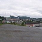
I-89 St. Albans to Swanton. 6-miles of interstate survey on both the north and south bound lanes including control traverse and topographic surveys for reconstruction of the sub-base and five bridge decks and seven culverts.
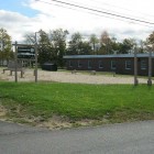
Roadway Improvement Projects. Under multi-year contracts, provided survey for 14 roadway improvement design projects, encompassing over 80-miles of roadway throughout the State of Vermont, including field survey, base mapping, and construction layout.
 VTrans Survey
-
 VTrans Survey
-
 VTrans Survey
-
 VTrans Survey
-
 VTrans Survey