Municipal

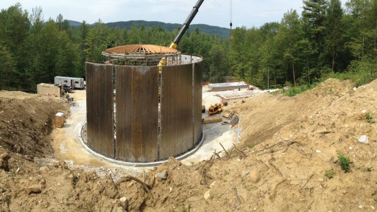
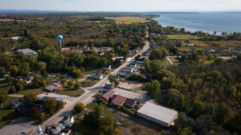
  • Alburgh Water System Improvements

    The Alburgh Village Water System (WSID 0005316) uses a surface water intake from Lake Champlain, a water treatment facility, and water mains to supply approximately 400 service connections and a population of 576. The water system included an elevated painted steel storage tank constructed in 1988 that served Alburgh’s Designated Village Center, South Alburgh Fire District No….

  • NH 3A-Dunklee Rd Intersection

    The NH 3A and Dunklee Road intersection previously existed as an unsignalized ‘T’ intersection that required operators of tractor-trailers to drive in the oncoming lane when turning right onto NH 3A—an unsafe condition. Located in an industrial/commercial context, NH 3A is frequently used to bypass a tolled section of I-93 near the I-93/I-98/NH-3A junction. Working…

  • US 7 Segment 6 Reconstruction

    The Town of Brandon needed to efficiently implement a wide range of improvements while minimizing the total duration of disturbance to a vital and distinctive downtown core that sees a high volume of passenger vehicle and heavy truck traffic. This US 7 Segment 6 project—a National Highway Performance Program project—replaced sidewalks, lighting, water, sewer, and…

  • Northfield Trail Wayfinding Plan

    The Town of Northfield sought to improve wayfinding for public trail networks, parking, and access points. Serving mountain bikers, skiers, trail runners, hikers, and ROTC students, the Town Forest and Norwich University trails are located in mountainous terrain with accesses in a residential area and on University property. The town maintains a separate school trail…

  • Merchants Row Rain Garden

    To collect, infiltrate, and treat stormwater from a one-block, one-way street with parking and sidewalks, D&K designed a rain garden and sidewalk extension. The project disconnects a significant amount of impervious surface from the closed drainage system and provides additional space for pedestrians to safely navigate the crossings at this four-way intersection. D&K provided survey,…

  • Flood Study of the Mad River Area

    The Mad River Valley is a rural though populous region characterized by steep slopes, narrow river channels, and a relatively high level of transportation infrastructure and building stock along valley floors and roads accessing resort areas. D&K worked with the CVRPC to survey the area and develop a study that cataloged the hydrology and hydraulics…