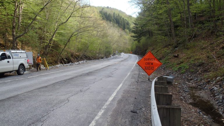
Survey and Mapping

  • Survey and Mapping

    D&K’s survey party chiefs and technicians are led and mentored by a senior licensed land surveyor. We provide topographic, property, hydrographic, bathymetric, right-of-way, and construction survey. Our survey parties establish horizontal and vertical control, as well as construction baselines and stakeout. Property survey services include deed research and preparation of property plats for filing with…

  • Alburgh Water System Improvements

    The Alburgh Village Water System (WSID 0005316) uses a surface water intake from Lake Champlain, a water treatment facility, and water mains to supply approximately 400 service connections and a population of 576. The water system included an elevated painted steel storage tank constructed in 1988 that served Alburgh’s Designated Village Center, South Alburgh Fire District No….

  • Geodetic Leveling at SMIAs

    At a range of Salt Marsh Integrity Areas (SMIAs) along the East Coast, the US Fish and Wildlife Service studies storm and climate change impacts to coastal wetlands using elevation data as one metric. Following Hurricane Sandy, FWS identified 10 locations that required additional survey control benchmarks. D&K inventoried and visited each site, performed geodetic…

  • Merchants Row Rain Garden

    To collect, infiltrate, and treat stormwater from a one-block, one-way street with parking and sidewalks, D&K designed a rain garden and sidewalk extension. The project disconnects a significant amount of impervious surface from the closed drainage system and provides additional space for pedestrians to safely navigate the crossings at this four-way intersection. D&K provided survey,…

  • 3340 Line Upgrade 

    At the Gorge Hydroelectric facility, power transmission lines cross the Winooski River close to the dam spillway presenting a substantial icing issue (from spillway spray) for the conductors. The facility’s staff regularly used a nearby utility bridge to stage ice removal activities, and the client was interested in modifying the transmission line to reduce or…

  • Flood Study of the Mad River Area

    The Mad River Valley is a rural though populous region characterized by steep slopes, narrow river channels, and a relatively high level of transportation infrastructure and building stock along valley floors and roads accessing resort areas. D&K worked with the CVRPC to survey the area and develop a study that cataloged the hydrology and hydraulics…

  • Fair Haven Park & Ride

    Located in the downtown core, adjacent to the Village Green, the Fair Haven Park and Ride lot consisted of lightly marked spaces with no separation from the roadway on either side. The large contiguous area of paved surface, lack of pedestrian facilities, and minimal striping provided a low level of service. Frequently used by residents…